Crater Lake National Park
Days One & Two - Crater Lake & Lassen Volcanic National Parks - 2025
I traveled to Oregon to photograph the Milky Way over Crater Lake - will I be successful?
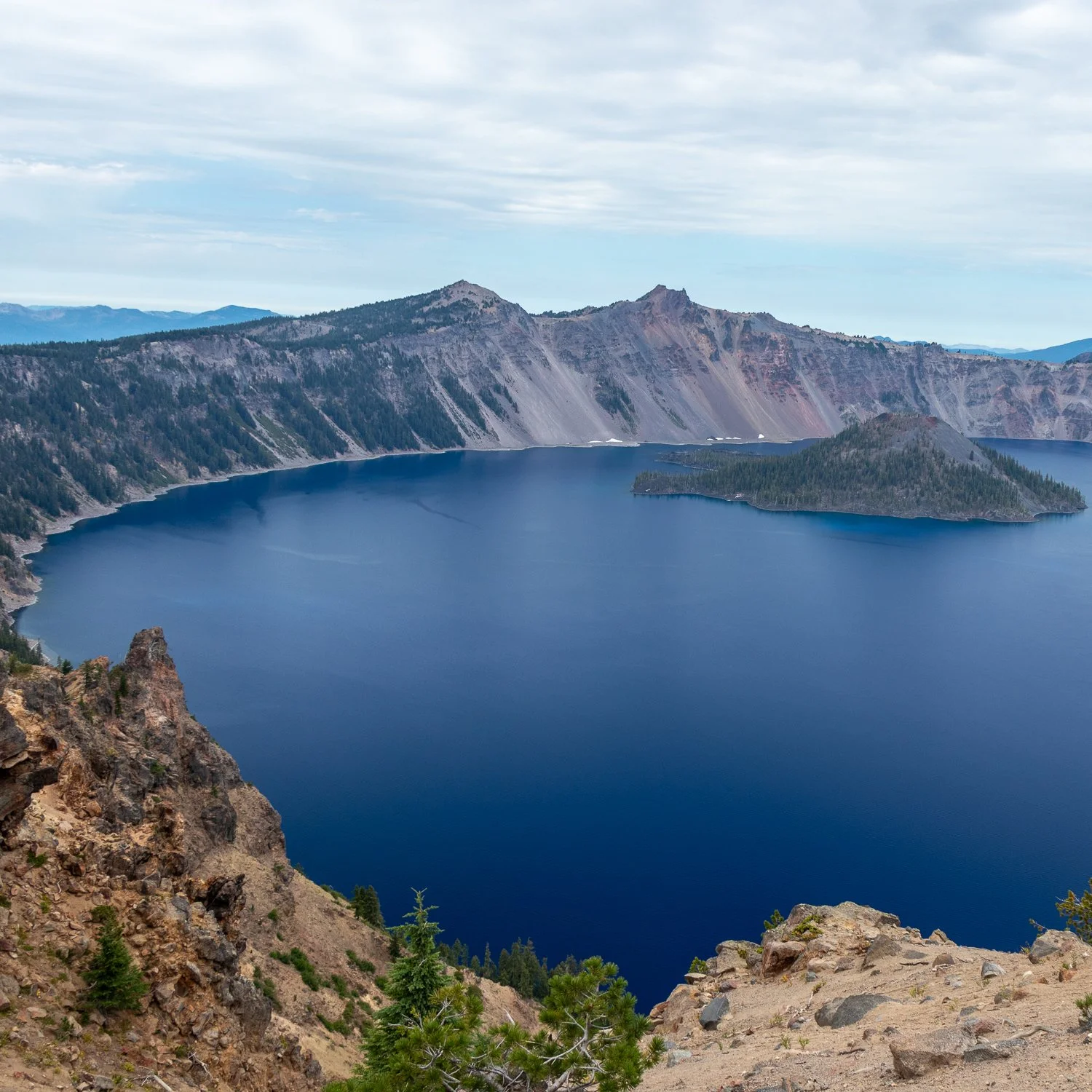
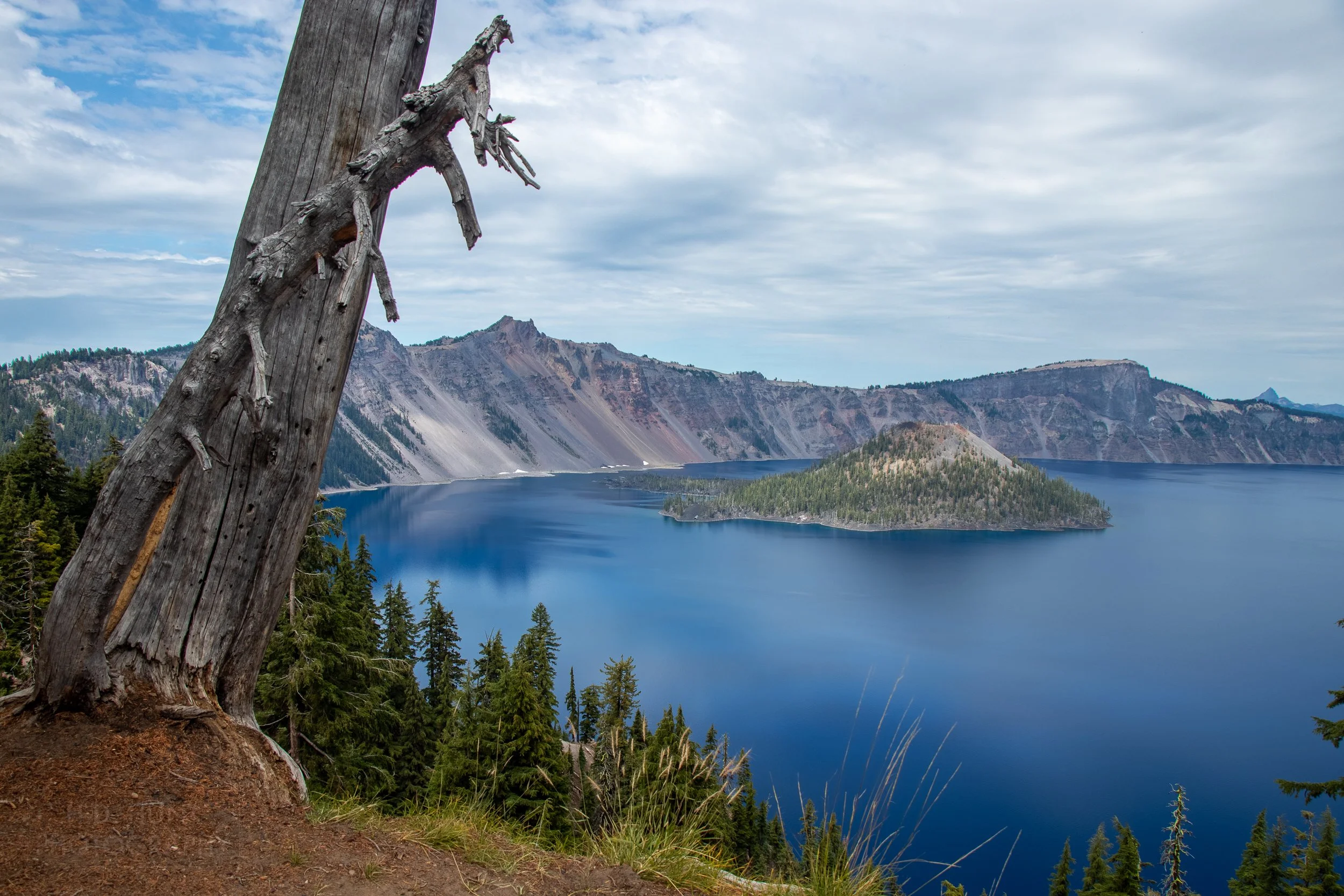
1. Garfield Peak #1
(Click here to view a full-size version of this panorama.)
Crater Lake was formed 7,500 to 8,000 years ago following the collapse of the Mount Mazama caldera.
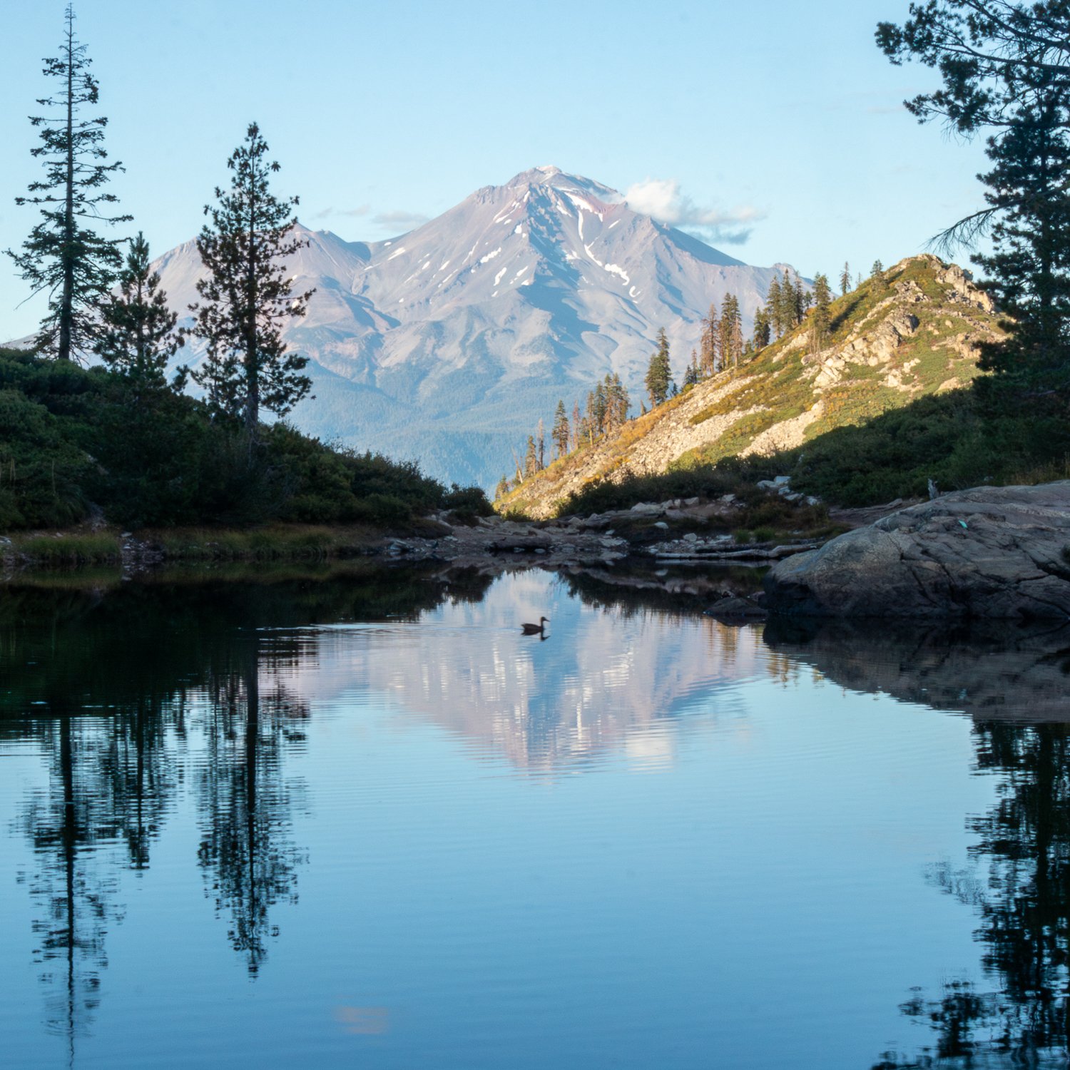
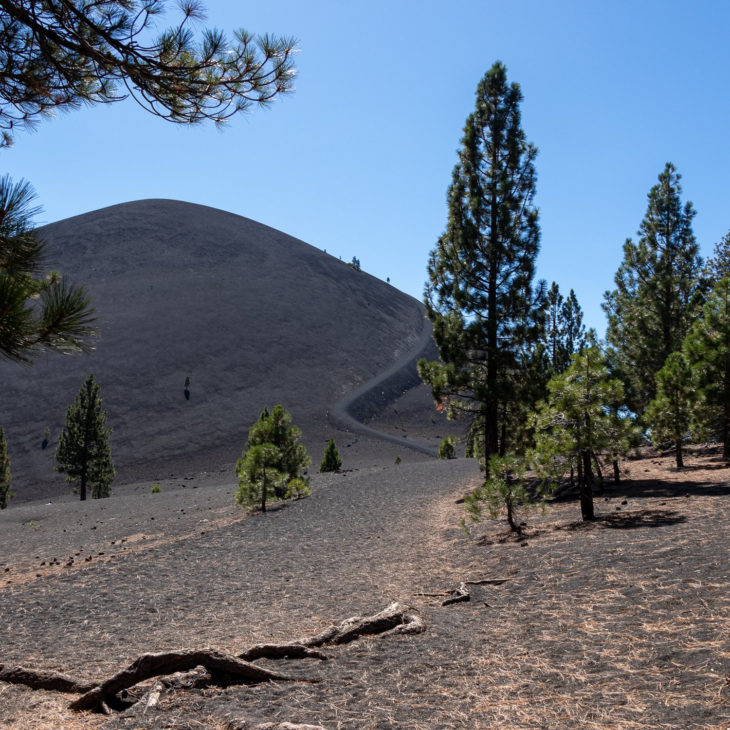
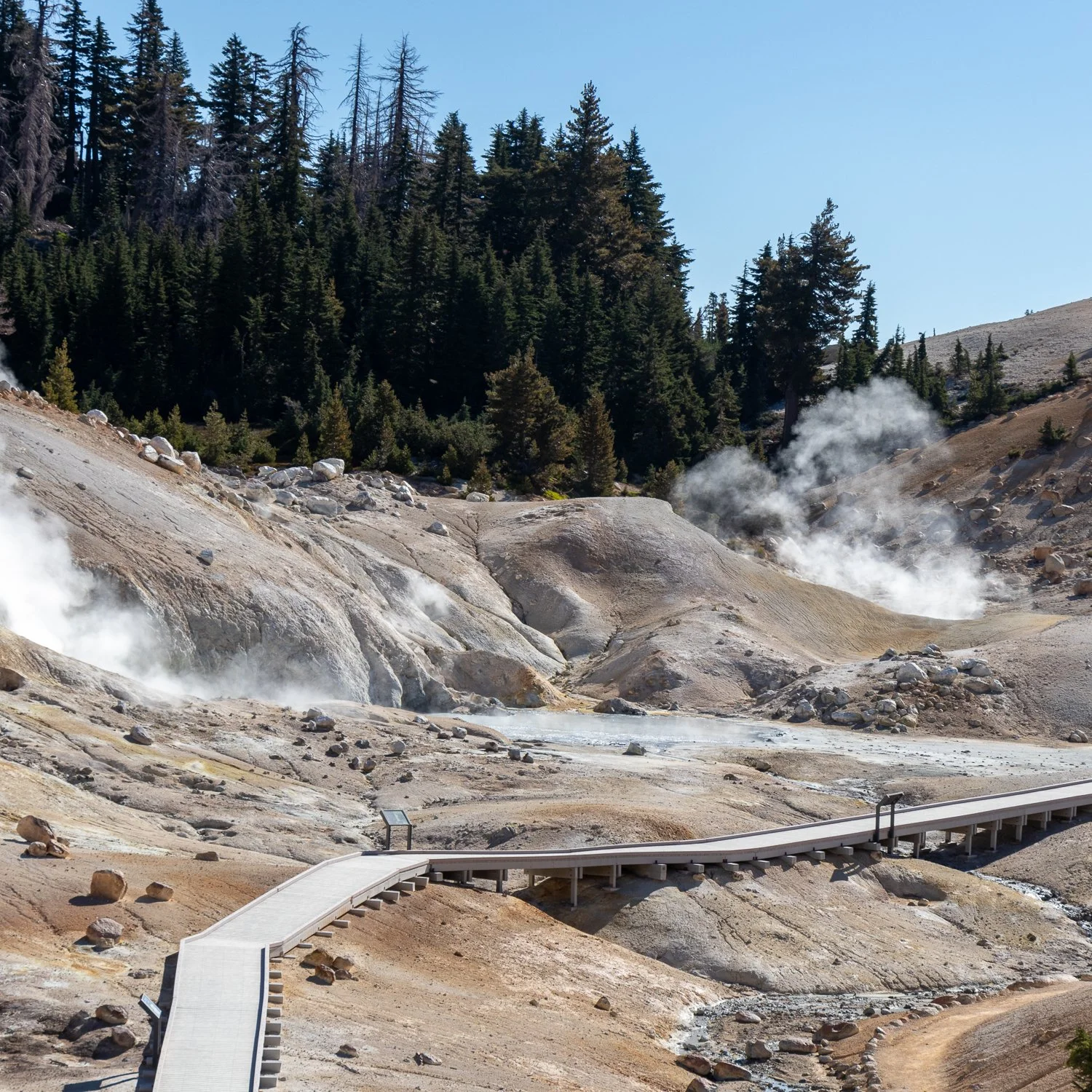
This is another one of those adventures I had planned for a very, very long time. The main objective was simple - photograph the Milky Way over Crater Lake. Now, it would have been a bit indulgent of me to fly from the East Coast of the United States to Oregon just for a photograph, so I added a second objective - hike Lassen Peak in Lassen Volcanic National Park. The reason for that: to serve as a preparatory hike for a Nepal hiking trip that I was going to do in Fall of 2025. I promise it will happen one day! But onto business in Oregon first.
The primary challenge in scheduling a trip for this purpose is that the visitation season for most of Crater Lake National Park is incredibly short, with the majority of Rim Drive -the road which circles the lake- closed between typically November and mid-June each year. This leaves four months and -by extension- only four, maybe five, moonless periods each year where such a photograph is possible. I picked late September if for no other reason than the night is much longer in late September than in late June. Anyway, I made my decision and it was up to fate at that point.
Crater Lake National Park is kind of in the middle of nowhere … I guess that’s the point if you think about it, but it does significantly complicate astrophotography logistics. If you don’t manage to book one of the very limited on-site accommodations, the nearest hotels are at least 40 minutes away. Trust me: trying to do that kind of driving after an evening’s shoot is a real hazard, so if you are going to try and catch the Milky Way at Crater Lake, do yourself a favor and stay on-site.
Thankfully I was able to book a room at the Mazama Village Campground lodges for the astrophotography night, so everything was falling into place. I just needed to get there first. I flew into Rogue Valley International - Medford Airport, a lovely regional airport with a whopping six gates, but a really convenient option if visiting the park. I arrived quite late in the evening, so I just stayed in Medford for the evening. My plan the following day was pretty straightforward: wake up extra early, drive to the park, knock out the hike up Garfield Peak before it got too busy, drive the Rim Road, then crash out early before waking up just after midnight to begin the shoot.
2. Garfield Peak #2
The current caldera is 2,148 feet / 655 meters deep …
The parking lot outside Rim Village and the Crater Lake Lodge -the trailhead of the Garfield Peak Trail- fills up unbelievably fast in the morning, so my gamble to get there early certainly paid off. The Garfield Peak Trail is 3.5 miles / 5.6 kilometers long with a rise of 1,076 feet / 328 meters. It is a pretty easy hike overall, but it can catch you off-guard if you are a flatlander as the trailhead sits at 7,110 feet / 2,167 meters. The summit of Garfield Peak provides an elevated 360-degree view of nearly the entirety of Crater Lake. I cannot recommend this trail enough!
Three more photographs from the Garfield Peak Trail follow.
3. Garfield Peak #3
… 1,949 feet / 594 meters of which is filled by Crater Lake.
4. Garfield Peak #4
Crater Lake has an average depth of 1,148 feet / 350 meters …
5. Garfield Peak #5
… Which makes Crater Lake the deepest lake in the United States and among the deepest in the world.
6. Sinnott Memorial #1
There are no outlet rivers or streams from Crater Lake …
After grabbing a quick bite to eat at the Rim Village Cafe, I made my way down to Sinnott Memorial. This is another great viewpoint of the lake, and a great option during inclement weather as it is covered.
7. Sinnott Memorial #2
(Click here to view a full-size version of this panorama.)
… Resulting in the water level being maintained by a balance of evaporation and rainfall / snowmelt.
8. Discovery Point
There are two islands on Crater Lake: the 316 acre / 128 hectare Wizard Island …
Having pretty much the remainder of the afternoon to explore the park, I headed out towards the east side of the lake. During my visit, a small portion of the Rim Drive was closed, making a full loop impossible; while the portion that was closed did not significantly limit sightseeing opportunities (Phantom Ship Overlook was closed), it did mean I would have to do a 3/4 loop before returning back in the opposite direction, costing some additional time. On the way I made a quick stop at Discovery Point in order to determine if this would make a good sunrise vantage.
9. Castle Rock Overlook
… And a small rock pillar called Phantom Ship.
With Phantom Ship Overlook being closed, the closest I could get to Phantom Ship was Castle Rock Overlook …
10. Sentinel Point Overlook #1
Known to Native Americans for millennia (perhaps even up to the date of its formation), Crater Lake was “discovered” in 1853 by explorers looking for a lost gold mine.
… And the nearby Sentinel Point Overlook.
11. Sentinel Point Overlook #2
“Rediscovered” several times in the following years, it was finally named “Crater Lake” by an exploration party in 1869.
Content with my photos on this side of the lake, I made for Watchman Peak, my last planned stop of the day.
We don't run ads - your follow on Instagram
lets us know how we're doing!
Thanks for your support!
12. Skell Head Overlook
Reading about the most recent “discovery” of Crater Lake in the newspaper which wrapped his school lunch in 1870, 15 year-old William Gladstone Steel began his life-long obsession with the site …
I made a couple of additional stops, one of which was Skell Head, which had a great view of the cliffs along the east side of Crater Lake.
13. Merriam Point Overlook
… And -after first arriving at the site in 1885- he began lobbying for Crater Lake as a recreation destination and -eventually- a National Park.
I stopped at Merriam Point to see if there was any east-looking viewpoint for astrophotography that night; there wasn’t but it made for a good photo during the daytime! I did consider stopping at Cleetwood Cove on the way, but - owing to the fact this was one of the last weekends Cleetwood Cove would be open for several years the parking lot was slammed. In fact, there were cars taking up every single gap along Rim Drive, as well. To me it wasn’t worth the hassle.
14. Watchman Overlook #1
Steel was successful and Crater Lake was declared the United States’ sixth National Park in 1902.
I took some time to explore possible vantage points for astrophotography that evening. It seemed like there was plenty of opportunity to set up a tripod a short distance from the parking lot, so I committed to shooting here.
15. Watchman Overlook #2
Steel’s legacy continues to this day in other ways: in 1888, he stocked the then uninhabited lake with fish, and non-indigenous fish continue to occupy the waters to this day.
16. Watchman Peak #1
(Click here to view a full-size version of this panorama.)
Steel was further instrumental in the creation of the 33-mile / 53-kilometer Rim Drive, which circles the approximately 22-mile / 35-kilometer shoreline of Crater Lake.
I made my way up Watchman Peak, and -wow- what a view! Another easy recommend for anyone able to make the journey. The walk up the trail isn’t difficult and well, well worth the effort.
17. Watchman Peak #2
It is important to note that -due to the high elevation of the lake- Crater Lake receives an incredibly amount of snow each winter (46 feet / 14 meters) resulting in the closure of Rim Drive from typically early November to late June.
After visiting Watchman Peak, I decided to check-in to my cottage at Mazama Village Campground and get as much sleep as I could muster … after a decadent meal of ramen noodles from the campground general store cooked using hot water from the coffee maker, of course….
18. Astrophotography at Watchman Overlook
Due to its elevation and distance from large cities, Crater Lake National Park is rated as a 1 on the Bortle Scale, indicating an “excellent dark-sky site.”
Waking up at about 1AM, I loaded up my gear in my rental car and set off for Watchman Overlook. I hadn’t really paid any attention to the weather because 1) I was asleep, and 2) it didn’t really matter at that point. The temperature was hovering around freezing so I made a quick coffee and bundled up for what would be a very cold morning. I made the 20 minute drive to the lookout and much to my disappointment it was cloudy. Sitting in the front seat of the car looking out over the horizon I figured, “I’m here, I might as well just see what I get.” That was only the half of it. Unfortunately, the wind was blowing incredibly strongly. Now, I realize that Crater Lake literally sits in a caldera at the top of a mountain, but I was not prepared for this! I hastily set up my travel tripod, fired off a few test shots, and said to myself, “This is never going to work.” Oh, well - nothing I could do about it. I ran a sequence for about 90 minutes while sitting in the front seat of the car, hearing the occasional but irritatingly frequent gusts of wind swirl by. I obviously don’t have any idea how fast the wind was blowing, but when it really picked up it would move the car side-to-side. Obviously, the above shot was not what I came for but rather it was what I could achieve given the circumstances.
Knowing what I know now, here’s what I will do the next time I come back to Crater Lake and attempt this photograph (there will be a next time!): first, I will bring my super-sturdy telescope-rated tripod, even if I have to check another bag; second, I will plan on spending multiple nights at the park to increase the odds of success, and; third, I will consider heading up to Watchman Peak - while it may be windier at the top, there is at least a large structure to break the wind a little bit. Lesson learned.
However, as you will soon see, there was a silver lining to this cloudy, windy catastrophe….
19. Sunrise From Discovery Point #1
Mount Mazama lost approximately 2,500 to 3,500 feet / 760 to 1,070 meters of its height when it erupted …
Dispirited, I cut my loses and headed to Discovery Point, my designated sunrise photography location. I took quite a bit of time to set up my tripod, try different angles, and test out filters. I finally found the vantage I wanted - now all I had to do was wait.
The rising sun gently began to turn the overhead clouds shades of pink and purple, which reflected softly off the still lake water.
20. Sunrise From Discovery Point #2
… And Crater Lake took over 700 years to fill thereafter.
This very quickly gave way to strong rays of orange and yellow light …
21. Sunrise From Discovery Point #3
Mount Mazama is considered dormant and no longer possesses magma reserves large enough to support a significant eruption; however, it is possible a smaller eruption may still occur, likely underneath the water, which could result in a tremendous wave within Crater Lake itself.
… Before consuming the purples and blues completely.
I realized rather quickly that none of this would have been possible on a cloudless morning. Nature taketh away, nature giveth.
Comments? Recommendations? Questions?
Let us know.